
State-Licensed Disposal Area
Aerial photo of the State-Licensed Disposal Area (SDA)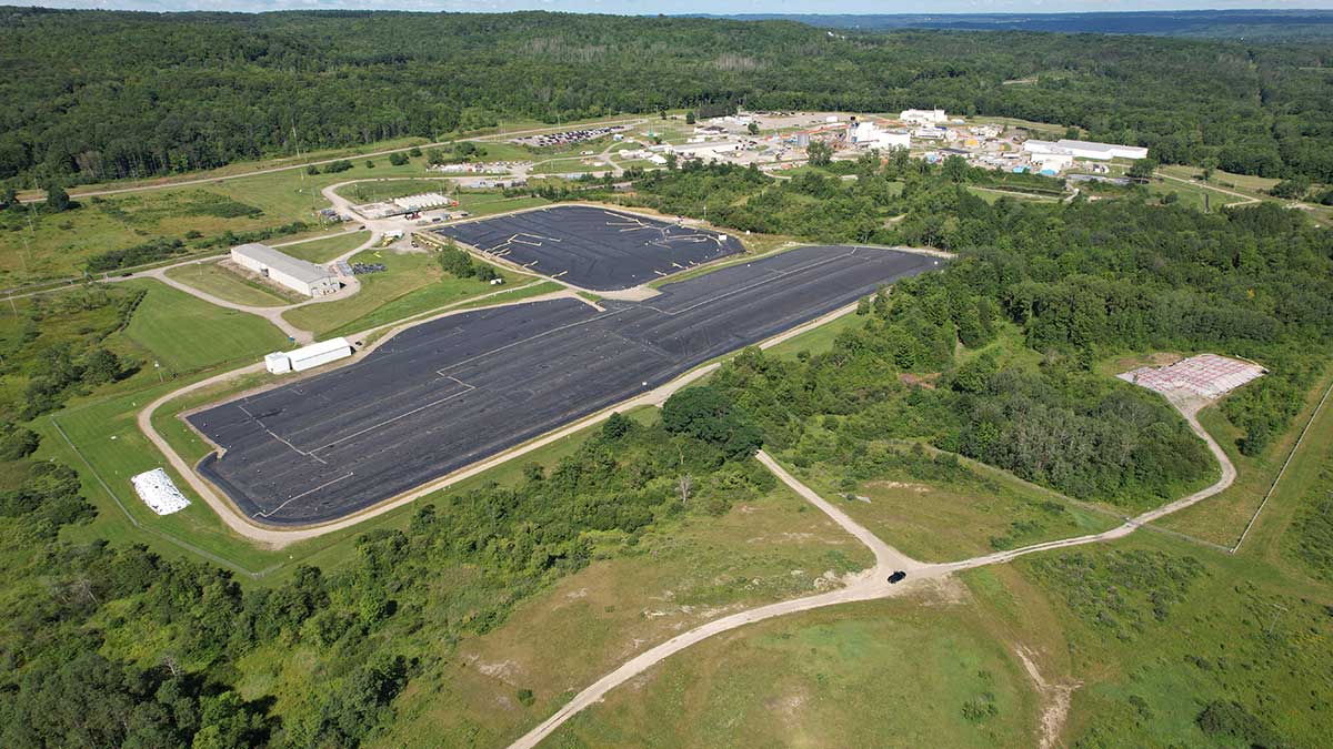
The State-Licensed Disposal Area (SDA) consists of 14 trenches containing approximately 2.4 million cubic feet of radioactive waste that accumulated from 1963 to 1975 when the Nuclear Fuel Services (NFS), a private contractor, handled disposal operations. The operations were terminated in 1975 when water infiltration caused contaminated water to overflow from the trenches.
Since 1983 when NYSERDA assumed management of the SDA, the West Valley Program has successfully minimized water infiltration into the disposal trenches by installing a protective cover over the trenches and prevented groundwater movement into the area. NYSERDA monitors environmental conditions at the SDA to continue its safe management. Long-term management is being addressed as part of the Environmental Impact Statement for Decommissioning and/or Long-Term Stewardship at the West Valley Demonstration Project and Western New York Nuclear Service Center [PDF|2.37 MB]. Currently, NYSERDA's preferred alternative is to continue active management of the SDA, under regulatory oversight, for up to 10 years.
NYSERDA continues implementation and improvement of ongoing environmental monitoring and maintenance activities in compliance with applicable regulatory requirements, including a New York State Department of Environmental Conservation radiation control permit, and a New York State Department of Health radioactive materials license. NYSERDA has effectively managed the SDA for the past three decades, and monitoring data and inspections show that the SDA is performing in a safe and compliant manner.
NYSERDA prepares quarterly and annual environmental reports for the SDA describing the status of activities and environmental monitoring being conducted in accordance with regulatory guidance.
- State-Licensed Disposal Area at West Valley: 2023 Annual Report [PDF]
- State-Licensed Disposal Area at West Valley: 2022 Annual Report [PDF]
- Environmental Impact Statement (EIS) for Decommissioning and/or Long-Term Stewardship of the West Valley facilities [PDF]
Meteorological and River Gauging Stations
NYSERDA installed meteorological instruments at the SDA to help safely manage the Center. Real time data collected on Buttermilk Creek near the confluence with Cattaraugus Creek assists with the day-to-day management, evaluation of stream flow, site erosion processes and weather and climate trends. These instruments measure wind speed and direction, barometric pressure, air temperature, relative humidity, and total precipitation, including amounts and intensities of rain, snow and hail.